In recent years, thermal imaging technology has transformed the landscape of drone capabilities, allowing for innovative applications in search and rescue, firefighting, and infrastructure inspection. Understanding which DJI drones come equipped with thermal imaging can empower both hobbyists and professionals to enhance their aerial missions. This guide delves into the remarkable world of DJI’s thermal models, revealing their unique features and practical uses. Whether you’re looking to elevate your photography, enhance operational efficiency, or ensure safety in challenging conditions, this exploration will provide valuable insights. Join us as we uncover the heat vision models from DJI and how they can elevate your aerial experiences and professional endeavors.
What Are Thermal Imaging Drones?
Thermal imaging drones have transformed how we gather data and conduct inspections across various fields. These specialized UAVs integrate advanced thermal cameras that capture infrared radiation, allowing operators to identify differences in temperature across objects and environments. By visualizing heat signatures, users can detect issues that are invisible to the naked eye, making thermal imaging drones invaluable for applications ranging from wildlife management to building inspections.
Applications of Thermal Imaging Drones
The ability to detect heat has numerous practical applications:
- Building Inspections: Thermal drones can quickly identify areas of heat loss, moisture issues, or electrical faults within structures, enabling proactive maintenance.
- Search and Rescue Operations: These drones can locate missing persons or navigate difficult terrains by detecting body heat, significantly speeding up recovery efforts.
- Agriculture Monitoring: Farmers can assess crop health by identifying temperature variations, helping optimize irrigation and pest control strategies.
- Wildlife Management: Drones can monitor animal movements without disturbing them, offering insights into behaviors and population counts, crucial for conservation efforts.
Equipped with cutting-edge imaging technology, thermal drones are proving indispensable in both commercial and recreational settings. As the technology matures, users can expect even broader capabilities and applications, continuing to enhance workflows and improve operational efficiency across industries.
Benefits of Using Thermal Drones for Aerial Surveys
The utilization of thermal drones in aerial surveys offers an innovative edge to data collection and analysis across multiple fields. These drones provide unparalleled insights by capturing thermal data that highlights temperature variations in real time. This capability not only enhances the precision of inspections but also significantly improves operational efficiency. For instance, industries such as construction, agriculture, and environmental monitoring leverage thermal imaging to identify issues that would be invisible during standard visual inspections. Whether it’s locating heat leaks in buildings or assessing crop health from above, thermal drones streamline processes while ensuring thorough and accurate data collection.
One of the most compelling benefits of thermal drones is their ability to operate in challenging conditions, such as low light or adverse weather. Unlike traditional methods, which may rely on sunlight or ideal visibility, thermal imaging can identify heat sources under various environmental circumstances. For example, during a nighttime search and rescue operation, these drones can detect body heat against a cold background, enabling quicker and more efficient rescue missions. This capability highlights the technology’s essential role in urgent situations, where every second counts.
Moreover, thermal drones are conducive to data analysis, allowing operators to visualize heat signatures and store this information for further evaluation. This long-term data collection supports trend analysis, essential for planning preventive maintenance within infrastructures or tracking wildlife movements over time. By integrating such data into Geographic Information Systems (GIS), professionals can make informed decisions based on comprehensive insights that traditional surveying methods might miss.
In summary, thermal drones not only enhance the accuracy and efficiency of aerial surveys but also provide invaluable data that can lead to significant cost savings and improved safety across industries. As technology continues to advance, these drones will further empower users to innovatively address complex challenges in monitoring and inspections.
Key DJI Drones with Thermal Imaging Capabilities
DJI is at the forefront of drone technology, particularly with its offerings that include thermal imaging capabilities. These drones not only provide aerial photography and videography but also excel in capturing heat signatures, making them indispensable tools for various professionals. Among the options available, a few standout models are particularly noteworthy for their thermal imaging functionality.
DJI Mavic 3 Thermal
The DJI Mavic 3 Thermal combines the high-performance features of the Mavic 3 series with advanced thermal imaging capabilities. This drone includes a dual-camera system featuring a 20MP wide-angle lens and a 640x512px radiometric thermal sensor, allowing users to capture both standard and thermal imagery simultaneously. With its robust flight time of up to 46 minutes and a range of intelligent flight features, this model is ideal for tasks such as search and rescue, industrial inspections, and agricultural monitoring.
DJI Matrice 300 RTK
The DJI Matrice 300 RTK is an industry-leading drone engineered for enterprise applications. This versatile platform supports multiple payload configurations, including the Zenmuse H20T, which features a thermal sensor, a 20MP zoom camera, and a wide-angle camera in one integrated device. The Matrice 300 RTK is equipped with advanced AI capabilities and redundancy features for enhanced safety and reliability, making it suitable for critical missions in public safety and infrastructure inspection.
DJI Zenmuse XT S
The Zenmuse XT S remains a popular choice for those needing specialized thermal imaging capabilities. This gimbal camera can be mounted on various DJI platforms, such as the Matrice series, and provides resolution options up to 640×512 pixels. The XT S is particularly praised for its thermal sensitivity, which allows for the detection of minute temperature differences, making it invaluable for electrical inspections, monitoring wildlife, and search and rescue operations in challenging conditions.
DJI Mavic 2 Enterprise Dual
For those seeking a compact solution, the DJI Mavic 2 Enterprise Dual is a powerful option. This drone features a dual-sensor system with a thermal camera and a 4K visual camera. With features like AirSense technology and a modular accessory system, it can adapt to various mission needs. Its ease of use and portability make it a practical choice for first responders and environmental monitoring professionals.
Each of these models showcases DJI’s commitment to integrating cutting-edge thermal imaging technology with user-friendly drone design. Whether you’re a professional pilot or a newcomer to thermal imaging, DJI offers a range of drones that cater to different needs and environments, ensuring comprehensive thermal analysis is just a flight away.
Comparison of DJI Thermal Drone Models
In the realm of thermal imaging drones, comparing DJI’s offerings can help users select the best model for their specific needs. Each drone boasts distinct characteristics tailored for various applications, from agriculture to search and rescue, making it crucial to understand how they measure up against one another.
The DJI Mavic 3 Thermal stands out with its robust dual-camera system. Sporting a 20MP wide-angle lens alongside a 640x512px thermal sensor, it delivers high-resolution imagery that caters to both visual and thermal analysis. With an impressive flight time of up to 46 minutes, it’s ideal for extended missions, such as surveying large tracts of land or performing detailed industrial inspections. Users appreciate its ease of use and portability, which makes it accessible for professionals and hobbyists alike.
In contrast, the DJI Matrice 300 RTK is engineered for enterprise-level applications, enabling complex missions requiring advanced automation and AI capabilities. This drone supports numerous payloads, with the Zenmuse H20T camera featuring both thermal and visual sensors for interactive data collection. Its advanced design includes redundancy features, making it the go-to choice for critical tasks in public safety or infrastructure monitoring.
For those needing a specialized thermal solution, the DJI Zenmuse XT S provides exemplary performance in detecting minute temperature differences, essential for applications like electrical inspections or wildlife monitoring. This gimbal camera’s compatibility with multiple DJI platforms adds versatility, allowing users to deploy it on drones best suited to their mission parameters.
Finally, the DJI Mavic 2 Enterprise Dual offers a compact design with a dual-sensor system, which combines thermal and visual imaging. Known for its user-friendly interface and AirSense technology, this model is particularly valuable for first responders requiring rapid deployment in emergency scenarios. Its modular accessory system enhances adaptability for various mission requirements.
To aid in your decision-making process, consider the following comparison of key specifications across these models:
| Model | Camera Resolution | Thermal Sensor Resolution | Flight Time | Payload Flexibility |
|---|---|---|---|---|
| DJI Mavic 3 Thermal | 20MP | 640x512px | Up to 46 mins | No |
| DJI Matrice 300 RTK | Varies with payload | Varies with payload | Up to 55 mins | Yes |
| DJI Zenmuse XT S | Varies by platform | 640x512px | N/A | Yes |
| DJI Mavic 2 Enterprise Dual | 4K | 640x512px | Up to 31 mins | Yes |
By understanding the key differences and finding the right balance of specifications, features, and use cases, drone operators can make informed decisions that enhance their operational efficiency and effectiveness in capturing thermal imagery. Whether you prioritize portability, advanced capabilities, or specialized thermal functions, DJI’s diverse lineup accommodates a variety of professional requirements.
Features to Look For in Thermal Drones
When diving into the world of thermal drones, recognizing essential features can significantly enhance your operational success. Thermal drones, particularly those manufactured by DJI, leverage advanced technology to provide high-resolution thermal imagery, making them invaluable for numerous applications such as infrastructure inspection, search and rescue operations, and wildlife monitoring. Here, we explore crucial features that ensure you select the right thermal drone tailored to your specific needs.
Camera Resolution
The camera resolution is a pivotal factor when evaluating thermal drones. Higher resolution cameras can capture finer details, enabling better analysis. For instance, DJI’s Mavic 3 Thermal boasts a 20MP visual camera complemented by a 640x512px thermal sensor. This combination ensures that you not only get clear thermal data but also stunning visual images. In contrast, lower resolution sensors may suffice for basic applications but can limit effectiveness in detailed inspections.
Thermal Sensitivity and Range
Another significant aspect is the drone’s thermal sensitivity and temperature range. Drones equipped with sensors capable of detecting small temperature differences (less than 0.1°C) provide more precise data. This specificity is critical during tasks like electrical inspections or identifying heat leaks in buildings. For example, the Zenmuse XT S, designed for detecting minor temperature variations, excels in precision-oriented applications, ensuring operational excellence.
Flight Time and Battery Life
Flight time influences both your range and the duration of your survey missions. Drones like the DJI Matrice 300 RTK offer up to 55 minutes of flight time, which can be particularly advantageous for extensive inspections. Longer flight durations reduce downtime and the need for frequent recharging or battery changes, allowing you to maximize your workflow efficiency.
Payload Capabilities
Evaluating the payload flexibility of thermal drones is essential, especially for users needing enhanced capabilities for specialized tasks. Drones such as the Matrice 300 RTK support various payloads, allowing integration of diverse sensors apart from thermal cameras. This adaptability is ideal for complex missions requiring multi-sensor setups, which can significantly improve data collection and analytics.
In summary, identifying features like camera resolution, thermal sensitivity, battery life, and payload flexibility not only aids in selecting the right DJI thermal drone but also empowers pilots to leverage these tools effectively in their operational contexts. Understanding these elements ensures you can make informed decisions that enhance your capabilities and efficiency in capturing thermal imagery.
How to Choose the Right Thermal Drone for Your Needs
Choosing the right thermal drone can greatly influence the success of your operations, whether you are inspecting infrastructure, conducting search and rescue missions, or monitoring wildlife. A well-selected drone equipped with thermal imaging capabilities can enhance your data collection, making your tasks more efficient and effective. With various models available, understanding key factors that align with your specific needs is crucial.
Start by identifying the primary application for which you’ll be using the drone. For detailed inspections of electrical grids or building thermography, look for drones with high thermal sensitivity and resolution that can capture minor temperature differences (below 0.1°C). The DJI Mavic 3 Thermal, with its 640x512px thermal sensor, excels in this area, making it a strong contender for professional applications that demand precision. Conversely, if you require a drone primarily for broad surveillance or search and rescue, prioritize models with longer flight times and versatile payload options to maximize your coverage area during operations.
Next, consider the integration of additional sensors or payloads that might be necessary for your projects. Drones like the DJI Matrice 300 RTK offer flexibility in mounting various equipment, from visual cameras to LiDAR systems, enabling multi-functional use. This adaptability is particularly valuable for professionals who may need to conduct different types of surveys with varying sensor requirements. Assess your future needs to ensure the drone can evolve with your tasks, thus providing a better long-term investment.
Additionally, examine the regulatory environment surrounding drone flights in your area. Some models may be equipped with features that facilitate compliance with local laws, such as built-in geofencing to restrict flight in sensitive areas. Educating yourself about these legal considerations will not only enhance the safety and legality of your operations but also influence your choice of drone.
In summary, selecting the appropriate thermal drone involves a careful evaluation of your intended use cases, desired technical specifications, and compliance with regulations. By aligning these factors with the capabilities offered by DJI’s thermal drone models, you can make an informed decision that enhances your operational effectiveness and elevates your data collection activities.
Understanding Thermal Imaging: Basics and Applications
Thermal imaging technology allows us to visualize infrared radiation emitted by objects, transforming temperature variations into visible images. This capability opens up numerous applications across various fields, enhancing both analysis and decision-making processes. With DJI’s prominent lineup of thermal imaging drones, users can leverage this technology for everything from industrial inspections to wildlife monitoring, providing a powerful tool for professionals and enthusiasts alike.
In practical terms, thermal imaging works by detecting differences in heat signatures. Objects that are hotter than their surroundings emit more infrared radiation, allowing drones equipped with thermal sensors to reveal patterns that are invisible to the naked eye. These capabilities are critical in various sectors:
- Search and Rescue: Thermal drones can locate missing persons or animals by detecting their body heat, even in dense vegetation or low-light conditions.
- Building Inspections: They help identify heat leaks in residential and commercial properties, allowing homeowners and contractors to implement energy-efficient solutions.
- Agriculture: Thermal cameras enable farmers to monitor crop health by detecting variations in moisture levels, which can indicate stress or disease.
- Firefighting: Firefighters utilize these drones to assess hotspots or monitor fire spread, especially in large wildfires where ground access is limited.
When selecting a DJI drone, understanding thermal imaging specifications is essential. Look for factors such as sensor resolution, ranging from 320×240 to 640×512 pixels, as this directly impacts the details captured in thermal images. Additionally, consider the drone’s ability to display thermal and visible light images simultaneously, which can enhance situational awareness during operations.
As you delve into the realm of thermal imaging, you’ll discover that it is not just about capturing heat; it’s about interpreting data to overcome challenges and make informed decisions. Emphasizing real-world examples, users can appreciate the breadth of applications available, empowering them to harness thermal imaging technology effectively in their respective fields.
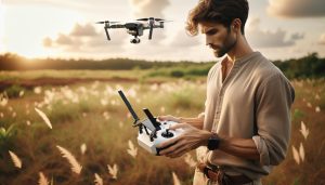
Setting Up Your Thermal DJI Drone: A Step-by-Step Guide
Setting up your thermal DJI drone is an essential step to ensure that you get the most out of its advanced capabilities. A well-prepared drone not only enhances performance but also improves safety and efficiency during your missions. Here’s a comprehensive step-by-step guide to help you get your thermal drone ready for action.
First, unbox your drone and check all components thoroughly. Ensure you have the drone, remote controller, batteries, propellers, and any included accessories. Charge the batteries fully before your first flight. It’s also important to download the latest version of the DJI Fly or DJI Pilot app, depending on your drone model, to access the most current features and firmware.
Step-by-Step Setup
- Firmware Updates:
- Connect your drone to the app via the remote controller. Follow the prompts to check for firmware updates.
- Install any available updates-it is critical for optimal performance and access to the latest features.
- Gimbal Calibration:
- Ensure your drone is on a level surface. Open the app and navigate to the gimbal settings.
- Follow the on-screen instructions to perform the calibration. This step helps your thermal camera function correctly and ensures accurate readings.
- Camera Settings:
- Access the thermal camera settings through the app. Adjust the thermal sensitivity and color palette according to your needs (e.g., black hot, white hot, or other options available).
- Enable dual-view mode if applicable, which allows you to see thermal and visual images side by side for better context.
- Pre-Flight Checks:
- Check the propellers for any damage and secure them properly.
- Perform a system check via the app to verify that all components are functioning properly.
- Ensure GPS signal is acquired and check the area for any potential obstructions or no-fly zones.
- Flight Mode Selection:
- Select the appropriate flight mode based on your mission. For thermal surveys, “Mapping” or “Surveying” modes might be used for precision.
Once these steps are completed, it’s time to take to the skies. It’s advisable to conduct a test flight in a controlled environment to familiarize yourself with the drone’s handling and thermal imaging capabilities. As a final note, always adhere to local regulations concerning drone operations, especially for thermal drones, which may have specific compliance requirements.
Getting your thermal DJI drone set up properly not only positions you for success on your aerial missions but also enhances the efficiency of your inspections, surveys, or any application you plan to leverage. Happy flying!
Tips for Capturing Effective Thermal Imagery
Capturing compelling thermal imagery with DJI drones requires a blend of technical understanding and practical techniques. Unlike standard visual photography, thermal imaging allows you to visualize heat patterns, making it especially useful for a variety of applications ranging from search and rescue to building inspections. To set yourself up for success, consider these essential tips.
One of the most crucial elements to optimize is the thermal sensitivity setting. Adjusting this can help reveal subtle differences in temperature between objects. For instance, when conducting an inspection of a building, setting the thermal sensitivity higher can make it easier to detect leaks or insulation issues that may not be immediately visible. Additionally, employing different color palettes can enhance contrast-“black hot” and “white hot” are popular choices, but trying out options like “ironbow” or “rainbow” can also provide clarity depending on your specific application.
Timing plays a significant role in thermal imaging effectiveness. Ideal conditions for capturing thermal images typically occur during the early morning or late afternoon when the sun has not yet fully warmed surfaces. This allows for greater temperature differentials, making abnormalities stand out more distinctly. Moreover, be aware of your surroundings. Vegetation can absorb heat and create interference, so aiming to capture images in areas with minimal foliage will lead to clearer results.
As you fly, use the manual flight mode for greater control over your drone’s altitude and positioning. Gently maneuvering allows you to hover over specific areas to capture multiple angles, which is particularly beneficial for detailed inspections. Additionally, consider utilizing features such as dual thermal and visual camera views, if available, to provide context to your thermal data. This can make it easier to interpret the results and identify any issues in real-time.
Lastly, always remember to review your images on-site. Assessing your captures while still airborne allows for adjustments and additional shots based on the initial assessment, ensuring you leave the location with the most useful data possible. With diligent attention to the settings, timing, and flight techniques, you can maximize the capabilities of your DJI thermal drone and capture effective thermal imagery reliably.
Challenges of Using Thermal Drones and How to Overcome Them
Operating thermal drones can offer incredible insights into heat patterns and anomalies, but several challenges exist that can hinder effectiveness. From environmental factors to technical limitations, addressing these challenges is crucial for maximizing your thermal imaging capabilities. A common issue is the influence of atmospheric conditions. Thermal imaging works best under optimal weather circumstances; overcast clouds, fog, or rain can distort thermal readings by introducing moisture that affects how heat is radiated and perceived. To mitigate this, plan your flights for days with clear skies and minimal wind, as thermal imaging benefits from stable atmospheric conditions.
Another significant challenge lies in interpreting thermal images accurately. Beginners may struggle to differentiate between temperature variations due to heat sources and environmental influences. To overcome this, investing time in understanding thermal imaging basics is essential. Familiarize yourself with thermal signatures of common materials and learn how to apply various color palettes effectively. Utilizing tools such as real-time comparisons between thermal and visual imagery can also aid in accurately assessing conditions at a glance.
Battery life is a critical consideration when operating thermal drones. Thermal cameras can consume more power than traditional cameras, potentially shortening flight times. It’s advisable to monitor flight durations and battery levels closely, planning for shorter missions initially to understand how long your specific drone can operate effectively in thermal mode. Consider keeping spare batteries on hand to ensure you’re not cut short during essential operations.
Additionally, regulatory and legal issues surrounding drone flights can pose challenges. Familiarization with local laws regarding drone operations, particularly for thermal imaging, is vital. Always ensure compliance with any regulations concerning privacy and airspace restrictions. Using appropriate authorization documents when required can keep operations smooth and trouble-free.
Finally, addressing the complexity of drone setups can help mitigate the steep learning curve associated with thermal drone operation. Thorough testing of all systems prior to flying can ensure equipment is functioning correctly. Regular firmware updates and maintenance checks will not only prevent technical failures but also enhance overall performance. By understanding these challenges and proactively developing strategies to tackle them, you’ll be better positioned to capture the most valuable thermal data possible with your DJI drone.
Legal Considerations for Operating Thermal Imaging Drones
Operating thermal imaging drones can significantly enhance your ability to capture vital information, but it is paramount to navigate the complex web of legal considerations before launching into the skies. Regulatory frameworks governing drone use vary widely from one jurisdiction to another, so it is crucial to know the specific laws that apply to thermal imaging operations in your area. In many regions, thermal imaging can raise privacy concerns, as these drones can potentially detect and visualize heat signatures from buildings and individuals, leading to invasions of privacy if not managed properly.
To comply with legal requirements, operators should begin by familiarizing themselves with local drone legislation, which may include restrictions on flying near populated areas, heights, and specific geographical zones such as airports or military installations. In some cases, a special waiver or authorization may be required to operate thermal imaging equipment, particularly in sensitive areas or for commercial purposes.
Key factors to consider include:
- Privacy Laws: Many states have enacted laws that govern the use of video and audio recording devices. When employing thermal imaging, ensure you do not infringe on individuals’ rights to privacy. Be mindful of not capturing imagery in areas where people have a reasonable expectation of privacy.
- Airspace Regulations: Consult the FAA or your country’s aviation authority for guidance on airspace restrictions. Drone pilots may need to file for airspace authorizations, especially when operating a thermal drone for commercial purposes.
- Insurance and Liability: Drone insurance can protect against potential damages or claims arising from an accident. Operators should consider obtaining coverage that includes thermal imaging capabilities to safeguard against the unique risks associated with their use.
- Documentation and Accessibility: Maintaining thorough documentation of all flight operations, including permits, logs, and maintenance records, can prove invaluable in demonstrating compliance during any regulatory audits.
In addition to legal compliance, being a responsible operator means respecting the environments in which you fly. Always prioritize community engagement and transparency about your drone activities, especially if they involve sensitive data collection. By staying informed and proactive about legal considerations, drone pilots can enhance public trust and ensure their thermal imaging operations contribute positively to their intended applications, whether in search and rescue, agriculture, or infrastructure inspections.
Best Accessories for DJI Thermal Drones
Equipping your DJI thermal drone with the right accessories can greatly enhance your aerial photography experience and data collection capabilities. When utilizing advanced imaging technology, such as thermal sensors, it’s essential to ensure your drone operates at its peak performance. Here are several accessories that can significantly elevate your thermal drone operations.
Batteries and Charging Solutions
To maximize your flight time – a critical component for capturing extensive survey areas or conducting inspections – investing in additional batteries is a necessity. High-capacity batteries reduce downtime and extend your operational endurance. Furthermore, consider a multi-battery charging station, which allows you to charge several batteries simultaneously, ensuring you’re always ready for your next mission.
Carrying Cases and Protection Gear
Protecting your drone during transport is paramount. A durable, well-padded carrying case not only safeguards your equipment from physical damage but also aids in organizing your accessories, such as spare batteries, propellers, and filters. Opt for cases designed specifically for your model, ensuring a snug fit and robust protection against the elements.
ND Filters
Neutral Density (ND) filters are particularly useful when flying in bright conditions, helping to control exposure and reduce glare on thermal images. These filters can enhance image quality by providing more consistent readings under varying light conditions, which is vital in capturing reliable thermal data.
Extra Propellers
Having spare propellers on hand is essential for any drone operator. Regular wear and tear, as well as potential accidents, can necessitate quick replacements to avoid downtime. Carrying high-quality backup propellers ensures that even mid-flight repairs can be carried out swiftly, allowing for uninterrupted operations.
Thermal Imaging Software
Beyond hardware accessories, integrating robust software designed for thermal image analysis can maximize the utility of your captured data. Software solutions can help in processing and interpreting thermal images more effectively, offering features like heat mapping and temperature analysis, thus making your thermal surveys more insightful.
By selecting the right accessories, you can enhance not only the functionality of your DJI thermal drone but also the efficiency and accuracy of your aerial surveying tasks. Proper preparation and suitable equipment are vital to navigating the complexities of thermal imaging successfully.
Faq
Q: What DJI drone models come with built-in thermal imaging capabilities?
A: DJI offers several drones with thermal capabilities, including the Matrice 30T and Mavic 3T. The Matrice 30T is equipped with a high-performance thermal camera, while the Mavic 3T combines thermal imaging with advanced optics for versatile applications.
Q: How does the thermal imaging technology in DJI drones work?
A: DJI’s thermal imaging technology detects infrared radiation emitted by objects, allowing for temperature differences to be visualized as images. This helps in identifying heat sources, making it useful for inspections and search and rescue operations.
Q: Can DJI thermal drones capture both thermal and optical images?
A: Yes, models like the Mavic 3T feature dual cameras that can capture both thermal and optical images simultaneously. This allows users to analyze data more effectively by comparing thermal images with standard visuals.
Q: What industries benefit the most from using DJI thermal drones?
A: Industries such as agriculture, construction, and emergency services greatly benefit from DJI thermal drones. They are used for crop health monitoring, building inspections, and search and rescue operations due to their ability to identify heat variations.
Q: What should I consider when choosing a DJI thermal drone?
A: When selecting a DJI thermal drone, consider factors like thermal resolution, flight time, payload capacity, and specific applications needed. Assessing these features helps ensure the drone meets your operational requirements effectively.
Q: How do I maximize the effectiveness of thermal imaging with my DJI drone?
A: To maximize thermal imaging results, ensure proper calibration of your drone’s sensors, select the appropriate imaging mode, and conduct flights during optimal environmental conditions, such as cooler temperatures, for clearer thermal differentiation.
Q: Are there any legal restrictions on flying DJI thermal drones?
A: Yes, there can be legal restrictions on flying thermal drones, particularly regarding privacy laws and airspace regulations. Always check local laws and regulations before operating to ensure compliance.
Q: What additional accessories are recommended for DJI thermal drones?
A: Recommended accessories for DJI thermal drones include extra batteries for extended flight time, ND filters for enhanced imaging quality, and a proper carrying case for safe transport. These can significantly improve usability and protection during flights.
To Wrap It Up
Thank you for exploring the fascinating world of DJI drones with thermal capabilities! As you’ve learned, these innovative models provide unparalleled heat vision technology, perfect for a range of applications from search and rescue to wildlife monitoring. If you’re considering upgrading your drone or diving deeper into thermal imaging, don’t wait! Check out our in-depth guides on the best DJI drones for various purposes, including the Mavic and Mini series, to help you make an informed purchase.
For more insights, be sure to read our articles on essential drone accessories and mastering flight techniques to enhance your flying skills. Have questions or want to share your experiences? Join the conversation in the comments below, and don’t forget to subscribe to our newsletter for the latest updates, tips, and exclusive offers. Your next aerial adventure awaits-take action today!