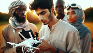
Navigating the skies with a DJI drone can lead to breathtaking views and unforgettable experiences. However, many aspiring pilots often find themselves grounded by no-fly zones due to legal restrictions or safety concerns. Understanding how to operate your drone legally in these areas is crucial not only for compliance but also for maximizing your aerial photography and exploration potential. This guide will delve into practical workarounds that ensure you can safely and legally fly your DJI drone even in restricted airspace. By learning these strategies, you can enhance your flying skills while remaining responsible, empowering you to capture stunning shots without stepping into legal trouble. Whether you’re a hobbyist wanting to expand your horizons or a professional seeking creative solutions, uncover the essential tips that will keep your drone soaring high.
Understanding No Fly Zones for DJI Drones
Navigating the skies with a DJI drone is exhilarating, but understanding no-fly zones is crucial for a responsible flight. No-fly zones are specific areas where drone operations are restricted or prohibited due to safety, security, or privacy concerns. These include regions near airports, military bases, and critical infrastructure. DJI drones are equipped with geofencing technology, which prevents them from taking off or flying into these restricted airspaces, helping operators comply with regulations while ensuring air safety.
To approach this from a practical standpoint, it’s essential to be proactive. Pilots can utilize the DJI Fly App or other compatible flight planning tools to verify their intended flight path against current geospatial data. This not only highlights designated no-fly zones but also informs users of any temporary restrictions that might be in effect due to events or emergencies, such as natural disasters or large gatherings.
If you find yourself near a no-fly zone, being informed and prepared allows for creative alternatives. For instance, consider flying in close proximity to the zone while remaining within legal limits, or exploring nearby open areas that are legally permissible for drone flight. Tools such as visual flight rules (VFR) maps or drone community apps can provide insights into local flying conditions and regulations, aiding in the selection of safe and compliant flight locations.
Investing time in education about no-fly zones not only protects you legally but also enhances your flying experience. By respecting these regulations, drone pilots can contribute to a safer airspace for everyone, build their reputation as responsible operators, and avoid potentially costly penalties.
Legal Implications of Flying in No Fly Zones
Flying a drone in no-fly zones is not just a regulatory hurdle but can lead to significant legal repercussions that every operator must understand. Navigating these areas requires a keen awareness of local laws, federal regulations, and the potential consequences of non-compliance. Engaging in unauthorized drone flights can result in hefty fines, enforcement actions from authorities, or even criminal charges, especially in sensitive areas like airports or military installations. For instance, the Federal Aviation Administration (FAA) imposes strict penalties on those who violate airspace restrictions, underscoring the importance of adhering to established guidelines.
Moreover, the legal landscape surrounding drone usage is evolving, with many municipalities and regions implementing their own regulations that may be stricter than federal laws. This variation makes it crucial for pilots to conduct thorough research about the specific rules applicable to their planned flight area. Failing to do so not only jeopardizes the pilot’s standing in the drone community but could also compel law enforcement to take action against the operator for infringing on local ordinances.
To navigate these complexities, operators should consider seeking advice from legal professionals experienced in aviation law specifically pertaining to drones. They can provide guidance on compliance strategies, such as obtaining special waivers or permissions from the FAA or local authorities when necessary. Being proactive about legal requirements can help protect against inadvertent violations, ultimately ensuring a safer and more enjoyable flying experience.
By respecting airspace regulations and understanding the legal implications of flying in no-fly zones, drone pilots not only safeguard themselves from penalties but also contribute to the broader safety of aviation and public wellbeing. A responsible approach to drone flying enhances the legitimacy of the operator and helps build trust within the community.
Navigating Drone Regulations: Essential Guidelines
When operating a DJI drone, understanding how to navigate through a web of regulations is essential for both the safety of the operator and the integrity of the airspace. With various local, state, and federal laws governing drone flight, being well-informed can make all the difference between a successful flight and a costly mistake. The key is proactive compliance, enabling drone pilots to effectively manage the complexities of airspace restrictions while enjoying the thrill of flight.
One of the first steps is to familiarize yourself with the Federal Aviation Administration (FAA) guidelines, which provide a comprehensive framework for drone operations. Pilots should ensure they know the current regulations applicable to their drone model, including maximum altitude limits, line-of-sight requirements, and no-fly zones. DJI drones come equipped with geofencing technology that restricts access to these areas, but understanding the surrounding laws is critical. For instance, many urban areas have specific zoning regulations that may impose additional constraints beyond federal guidelines, making comprehensive pre-flight research indispensable.
Additionally, utilizing technology can greatly assist in navigating regulations. Applications and tools like Airmap or SkyVector offer real-time data on airspace limitations, highlighting areas where flying is permitted or prohibited. Moreover, integrating this data with DJI’s own apps can provide alerts for restricted airspace, ensuring pilots remain informed. Keeping your drone’s firmware updated is also essential, as manufacturers like DJI often issue updates that refine geofencing and enhance flight features.
For those seeking to operate in no-fly zones, the process involves understanding how to seek permission appropriately. This might include applying for airspace authorization through the FAA’s LAANC (Low Altitude Authorization and Notification Capability) system or directly contacting local law enforcement or military authorities for specific permissions. Documenting all communications and permissions is important in case any questions about legality arise post-flight. Engaging proactively with the community can also provide insights into best practices and potentially lucrative opportunities for collaboration with other pilots who have successfully navigated these waters.
By cultivating a thorough understanding of the legal landscape, pilots not only restrict their chances of incurring penalties but also promote a culture of responsibility and safety within the drone community. This advocacy bolsters public confidence in drone operations, fostering an environment where innovative uses of drone technology can flourish unhindered by fear of regulation violations.
Identifying Areas with Restricted Airspace
Identifying restricted airspace is crucial for any drone pilot, particularly those flying DJI drones. The landscape of air travel is divided into various zones that restrict or prohibit flying due to safety concerns, local regulations, or national security. Understanding how to navigate these zones effectively not only ensures compliance with the law but also enhances the safety of your drone operations.
To get started, familiarize yourself with the primary categories of restricted airspace, which may include:
- Class A, B, C, D, and E Airspace: Each class has different rules that dictate how and when drones can operate. Class B airspace encompasses major airports and typically requires authorization to fly.
- Temporary Flight Restrictions (TFRs): These are short-term restrictions established for specific events, such as natural disasters or VIP movements. Staying informed about current TFRs is essential for planning flights.
- No-Fly Zones: DJI’s geofencing technology automatically restricts flight in certain high-risk areas, such as near airports, military bases, and national parks.
Utilizing resources like the FAA’s sectional charts, which detail airspace boundaries, can help pilots visually identify areas that are off-limits. Additionally, drone-specific apps such as Airmap or UAV Forecast provide real-time updates and alerts on airspace restrictions. These tools are invaluable for preparing for a flight, ensuring that you remain within permitted areas and avoid incurring penalties or fines.
While the DJI app includes built-in geofencing features to restrict access to no-fly zones, being proactive about checking airspace status before every flight is vital. Local laws may impose additional restrictions that DJI’s technology does not account for, making it imperative for pilots to conduct research and stay informed about their flying environment. Consequently, maintaining a robust understanding of the airspace landscape enhances not only legal compliance but also flight safety and operational success.
Utilizing DJI’s Geofencing Technology
Understanding the capabilities and limitations of DJI’s geofencing technology is essential for any drone pilot looking to navigate restricted airspace legally and safely. This technology is designed to prevent drones from flying into areas where flight poses significant risks or violates local laws. By utilizing these built-in features effectively, pilots can enhance safety, ensure compliance, and avoid potentially severe penalties associated with unauthorized flights.
DJI’s geofencing system operates using a combination of GPS data and detailed mapping of no-fly zones, which include airports, military installations, and other sensitive areas. When you attempt to fly your drone within these zones, the app will display a warning, and in some cases, the drone will physically restrict flight operations. Such built-in safeguards are vital for preventing accidents and maintaining responsible flying practices. To leverage this technology optimally, it’s crucial for pilots to keep their DJI software updated as regulations and geofencing databases can change over time.
Moreover, understanding how to interact with DJI’s geofencing can help pilots plan their flights better. For instance, when preparing for a shoot in a location close to restricted airspace, pilots can use the DJI Fly app to check geofencing settings and plan their flight path accordingly. If an area you wish to fly in is near a no-fly zone, you might explore alternative flight routes that still meet your filming needs without breaching regulations. Additionally, home locations can be adjusted in the app to ensure your flying remains compliant relative to your position.
While geofencing serves as an effective barrier, it can sometimes complicate legitimate flight activities, especially in regions where pilots face unnecessary restrictions. Be proactive and utilize tools such as Sectional Charts or apps like UAV Forecast alongside DJI’s integrated systems to verify your flight eligibility continuously. This comprehensive approach allows drone operators to maintain an aware and adaptive mindset, ensuring they stay informed of both their capabilities and limitations in the ever-evolving landscape of drone regulations.
Workarounds for No Fly Zones: What You Should Know
Navigating the sky can be complex, especially when it comes to flying your DJI drone in areas marked as no-fly zones. While DJI’s geofencing technology is designed to enhance safety by restricting flights in sensitive areas, there are instances where pilots may seek legal workarounds to access these locations without compromising compliance. Here are essential strategies and considerations to keep in mind when attempting to fly in no-fly zones while adhering to regulations.
First and foremost, consider seeking temporary authorization. Aviation authorities in various regions allow pilots to apply for waivers or permissions to fly in restricted airspace for specific purposes, such as filming or surveying. This usually involves submitting a detailed flight plan, including the proposed location, time, height, and reasons for the flight. Giving thorough information and demonstrating awareness of the local regulations can increase the likelihood of obtaining permission. Be prepared to follow stringent protocols, including notifying air traffic control or adhering to specific altitude restrictions during the flight.
Another approach involves utilizing DJI’s built-in features to adjust your home point or operating location. For example, if you’re near the edge of a no-fly zone, moving your home point just outside the restriction can allow you some flexibility while keeping within the law. Additionally, consider using advanced planning tools such as sectional charts, which provide detailed mapping of controlled airspace, to plan your flight path judiciously. These tools can help you identify nearby safe areas where you can launch and operate your drone without infringing on no-fly regulations.
Additionally, maintaining an open line of communication with local authorities, such as landowners, police, or aviation officials, can provide clarity on specific local restrictions. Some areas might have been designated as no-fly zones for particular reasons, and understanding the rationale can foster better relations and possibly grant exceptions depending on the activity planned. Always prioritize safety, not only for your drone and photography needs but also for people and private property in and around your flight area.
Being aware of real-time updates on geofencing changes is paramount. DJI frequently updates its geofencing database, influenced by regulatory changes or newly established restrictions, which could affect your flight plans. Keeping your app updated ensures that you have the most current information, aiding in compliance and avoiding unintended violations that could lead to hefty fines or penalties.
In summary, while no-fly zones can present hurdles, they can also foster a heightened sense of responsibility and caution among drone operators. Using these strategies helps pilots navigate the complexities of drone regulations while maintaining the ability to capture stunning imagery and fulfill their operational needs. Always approach each flight with a commitment to legality and safety, ensuring that your passion for drone flying aligns with responsible use.
Seeking Permission: How to Get Authorized
Though the allure of capturing breathtaking aerial imagery in no-fly zones can be tempting, complying with aviation regulations is imperative. Seeking proper authorization before flying in these restricted areas not only keeps you on the right side of the law but also enhances safety for everyone involved. Establishing a clear process for obtaining permission will empower drone operators to make responsible choices while still achieving their operational goals.
To begin with, familiarize yourself with the specific aviation authority governing the area where you intend to fly. Each country has its own regulatory body-such as the FAA in the United States or EASA in Europe-responsible for the creation and enforcement of airspace restrictions. Start by visiting their official website, where you can often find forms and guidelines specifically for applying for temporary waivers or permissions to operate within no-fly zones.
When preparing your request for authorization, be sure to provide comprehensive details regarding your planned operation. Include information such as the exact location, date, and times of your flight, as well as the purpose behind it-whether it’s for commercial filming, surveying, or another legitimate reason. The more detailed your submission, the better the chances that the authorities will see your request favorably. Especially if flying close to sensitive locations like airports or public events, demonstrating awareness of local regulations and necessary safety measures will be vital.
Additionally, maintain a proactive approach by keeping lines of communication open with relevant local authorities. Engaging with air traffic control, local law enforcement, or other nearby drone operators can provide vital information regarding any specific considerations or nuances tied to the area. This transparency can not only facilitate smoother interactions but may also yield insights that help adjust your flight plans in a compliant manner.
Lastly, be prepared for the possibility that your request could take time to process or may be denied. Therefore, planning ahead is essential. Having alternative locations or backup plans, where you can operate without the need for complex permissions, will ensure that your flying endeavors remain fruitful while strictly complying with regulations. By approaching these legal requirements with diligence and respect, drone pilots can enjoy their passion while promoting safe and informed flying practices.
Understanding Temporary Flight Restrictions
Navigating the complexities of airspace regulations is crucial for any drone operator, particularly when it comes to (TFRs). TFRs are established by aviation authorities to safeguard sensitive areas, such as those surrounding major sporting events, natural disasters, or temporary military operations. Recognizing and adhering to these restrictions is not only a legal obligation but also pivotal in maintaining safe skies for all users.
When TFRs are enacted, they are typically communicated through various channels such as NOTAMs (Notices to Airmen), FAA updates, and apps designed for drone pilots. Familiarizing yourself with these resources is essential for staying informed. For instance, using apps like SkyVector or Airmap can provide real-time updates on restricted areas, enabling effective flight planning. If you’re operating a DJI drone, utilize its built-in geofencing technology which automatically prevents takeoffs in areas subject to TFRs, further enhancing operational safety.
Types of Temporary Flight Restrictions
There are a few types of TFRs you might encounter, including:
- Event TFRs: These are typically set up around large public events, requiring operators to avoid areas where the event is occurring.
- Security TFRs: Implemented for national security, often around government buildings, creating exclusion zones for unauthorized aircraft.
- Emergency TFRs: Established temporarily in response to natural disasters or emergency situations, ensuring air operations do not interfere with emergency services.
Understanding the specific nature of a TFR is key to compliance. For example, if you plan to film a landscape near a sunset event that has a TFR, not only must you respect the operational boundaries established, but you should also acknowledge that penalties for non-compliance can be severe, including hefty fines or the confiscation of equipment.
In situations where your intended operation coincides with a TFR, proactive communication is essential. Contacting local authorities or the regional air traffic control center may provide you with updated information and potentially allow for exceptions or special permissions under specific circumstances. Always document these communications to further strengthen your operational credibility.
Plan Ahead for Compliance
Having a robust plan for navigating TFRs involves using available technology and resources while staying informed.
Prepare for your flight by taking the following steps:
- Check the latest TFR updates on official aviation websites.
- Utilize drone-specific apps that provide airspace information.
- Keep an eye on local news, as events can trigger sudden TFRs.
- Have alternative plans to operate in non-restricted areas should TFRs affect your initial flight path.
By establishing these practices, drone operators can enjoy their flying experience without the stress of legal repercussions, fostering a safe and compliant aerial community.
Drone Flight Insurance: Protecting Yourself Legally
Flying a drone can lead to exhilarating experiences, but it also comes with unique legal challenges, especially regarding no-fly zones. To safeguard your operations and financially protect yourself against potential liabilities, obtaining drone flight insurance is essential. This type of insurance is not just a safety net; it’s a proactive measure that covers damages to third parties, property, or even your equipment in the event of an incident.
In distinguishing between various insurance types, two primary categories usually stand out: liability coverage and hull insurance. Liability coverage protects you against claims filed by third parties who might suffer injury or property damage as a result of your drone operation. For example, if your drone accidentally collides with a person or interferes with another aircraft, this insurance will cover legal fees and compensation claims. On the other hand, hull insurance specifically covers the cost of repairing or replacing your drone in case of damage from crashes, theft, or loss due to accidents, especially crucial for costly DJI models.
Before purchasing insurance, it’s important to assess your specific needs and operational scope. Conduct thorough research on potential providers, analyzing their coverage limits, exclusions, and any additional riders that might enhance your policy. For instance, if you frequently film near no-fly zones or temporary flight restriction areas, discussing coverage for fines or legal defense costs related to regulatory violations with your insurer could add an extra layer of protection. Always read the fine print, as exclusions can vary significantly between policies.
Leveraging this insurance not only mitigates financial risks but also fosters a culture of responsibility within the drone-operating community. Being insured can enhance your credibility as a pilot, particularly in professional settings where clients might require proof of coverage before hiring you for their projects. Ultimately, equipping yourself with drone flight insurance is a wise investment in your safety, your equipment, and your future in the sky.
Safety Practices for Flying Near No Fly Zones
Flying near no-fly zones can be a daunting challenge for drone operators. However, understanding and applying key safety practices can significantly reduce risks and enhance the safety of your operations. One of the most essential guidelines is to always verify the airspace regulations before launching your DJI drone. Utilize reliable apps and online tools, such as the FAA’s B4UFLY app or DJI’s own geofencing technology, to check for any temporary flight restrictions or designated no-fly zones in your planned flight area.
Another critical practice is to maintain visual line-of-sight with your drone at all times. This not only helps in avoiding obstacles and other aircraft but also ensures you can react swiftly should you approach a restricted area. If you must operate near a no-fly zone, consider establishing an altitude limit well below any potential over-flight restrictions. This added precaution can help prevent inadvertent incursions into restricted airspace.
Before your flight, ensure you have the latest firmware updates for your drone. DJI regularly updates its software to enhance safety features and improve geofencing capabilities. Additionally, familiarize yourself with the return-to-home (RTH) function of your drone. Setting a safe altitude for the RTH feature can provide extra security should the drone lose connection or battery power, ensuring it does not inadvertently venture into a no-fly zone while returning.
Lastly, preparation is key. Conduct a thorough risk assessment, identifying potential hazards in the area you plan to fly. This could include assessing the proximity of airports, sensitive areas, and other prohibitive zones. Informing local authorities or seeking necessary permissions where applicable can also streamline your flight operations while ensuring compliance with legal stipulations. By embracing these safety practices, you empower yourself to fly responsibly while navigating the complexities of airspace regulations.
Alternatives to Flying in Restricted Areas
Flying a drone can be an exhilarating experience, but encountering no-fly zones can quickly dampen the excitement. However, numerous alternative options allow drone operators to achieve their goals while adhering to regulations. Understanding these alternatives not only enhances your flying experience but also empowers you to operate responsibly within the legal framework.
One effective strategy is to seek out areas adjacent to no-fly zones. Just because a specific location is restricted does not mean the surrounding areas are. Research parks, open fields, or other public spaces that lie just outside restricted airspace. Websites like Airmap or the FAA’s B4UFLY app are invaluable in pinpointing airspace boundaries. By creatively adjusting your launch location while remaining compliant, you can still capture stunning aerial footage without falling into the pitfalls of regulatory violations.
Another path is to collaborate with local authorities or landowners to receive temporary authorization for specific flights. If you have a legitimate project or reason for needing access to a no-fly zone, don’t hesitate to reach out. Many governmental agencies have processes to grant waiver requests for drone flights under controlled conditions. Preparing a solid plan that outlines your intentions, safety measures, and how the flight will be conducted can significantly increase your chances of receiving approval.
Additionally, consider enhancing your skill set with advanced drone features that mitigate risks. Drones like the DJI Mavic series come equipped with intelligent flight modes, obstacle avoidance systems, and GPS-based flight planning. Utilizing these features can help you navigate close to no-fly zones with greater precision, reducing the likelihood of accidental incursions. Focus on honing skills in alternative settings like indoor environments or vast, open spaces where regulations are less stringent, allowing for practice without facing the discipline of restricted airspace.
Lastly, engaging with the drone pilot community can also expose you to innovative alternatives. Forums, local meetups, or online groups often share information about lesser-known flyable locations, techniques, and experiences that can provide insights into obedient and productive drone operation. Continuous learning and sharing knowledge with fellow drone pilots can only enhance your flying repertoire and keep you informed about regulatory changes that may create new opportunities.
Essential Tools for Drone Pilots Navigating Regulations
Navigating the intricate web of drone regulations is crucial for every pilot, especially when flying near no-fly zones. Having the right tools at your disposal can make this pursuit not only easier but also significantly safer. Key resources will empower drone operators to stay compliant while still achieving their aerial goals.
One of the most effective tools for any drone pilot is a comprehensive flight planning app. Applications like Airmap and SkyVector provide real-time airspace information, helping you identify no-fly zones, temporary flight restrictions, and other critical airspace data before you launch. These apps allow you to input your flight path and receive instant feedback about any regulatory hurdles you may encounter, ensuring that you can plan your flights accordingly.
Furthermore, utilizing DJI’s built-in geofencing technology is indispensable. DJI drones come equipped with geographic restrictions that prevent flight in prohibited areas. Familiarize yourself with your drone’s geofencing capabilities through the DJI Fly app or DJI GO 4 app, which not only informs you about restricted areas but also provides updates on local airspace changes. Keeping your firmware and software up to date ensures that you have the most accurate information available, which is critical in avoiding unintentional violations.
It’s also beneficial to stay connected with the community of drone pilots. Engaging with online forums, local flying clubs, and social media groups can provide insights and shared experiences about flying in sensitive areas. Participating in discussions can reveal lesser-known resources and strategies other pilots have successfully utilized to navigate regulations. Meeting with fellow hobbyists or professionals can inspire confidence and provide innovative solutions for overcoming regulatory challenges.
Lastly, having access to reliable customer support from drone manufacturers, such as DJI’s assistance hotline or online resources, can be invaluable. If ever in doubt about specific regulations or how to operate within them, contacting support can clarify uncertainties and ensure safe flying. With these essential tools and resources at your fingertips, you can confidently approach your flights, knowing you’re adhering to the legal framework while still capturing amazing aerial imagery.
Frequently Asked Questions
Q: What are the safest ways to fly a DJI drone near a no-fly zone?
A: To fly safely near a no-fly zone, always stay within legal boundaries, utilize DJI’s geofencing technology, and familiarize yourself with local airspace regulations. Consider conducting flights during off-peak times and maintain communication with local aviation authorities for clearance if necessary.
Q: Can I get permission to fly my DJI drone in a no-fly zone?
A: Yes, you can often obtain permission to fly in no-fly zones by applying for a waiver through the relevant aviation authority. Prepare to provide the purpose of your flight and any safety measures you intend to implement. Visit the Seeking Permission section of the article for detailed guidance.
Q: What are the legal consequences of flying a DJI drone in restricted airspace?
A: Flying a drone in restricted airspace can lead to hefty fines, legal prosecution, and potential confiscation of the drone. It is essential to educate yourself on the implications and adhere strictly to regulations discussed in the Legal Implications section of the article.
Q: How can geofencing help prevent unauthorized drone flights?
A: Geofencing features prevent drones from taking off in prohibited areas by using GPS coordinates. DJI’s geofencing technology automatically restricts flights in no-fly zones, enhancing safety and compliance. Make sure to update your drone’s software for the latest geofencing data.
Q: What should I do if I need to fly near a temporary flight restriction?
A: To fly near a temporary flight restriction (TFR), monitor updates through official aviation channels and seek a NOTAM (Notice to Airmen) for details. If a TFR exists, it’s advisable to postpone your flight or choose an alternative location as discussed in the Understanding Temporary Flight Restrictions section.
Q: Are there drone flight insurance options for flying in no-fly zones?
A: Yes, drone flight insurance typically covers legal liability, including potential incidents while operating in restricted areas. Check with insurers that specialize in drone insurance to understand coverage options and limitations, as mentioned in the Drone Flight Insurance section of the article.
Q: Where can I find tools to check for no-fly zones while planning my drone flight?
A: To check for no-fly zones, use online resources like the FAA’s UAS Data and the DJI Fly Safe Map. These tools provide real-time data on restricted airspace and help you plan your flights accordingly. Refer to the Essential Tools for Drone Pilots section for more resources.
Q: What are the best practices for flying a DJI drone near no-fly zones?
A: Best practices include conducting thorough research on flight regulations, using DJI’s geofencing warnings, maintaining awareness of your surroundings, and notifying local authorities of your intent to fly near restricted areas, as guided in the Safety Practices for Flying Near No Fly Zones section.
The Way Forward
As you explore the skies with your DJI drone, remember the important strategies discussed for flying in no-fly zones legally and safely. Armed with the right information and tools, you can maneuver through challenges while staying compliant with regulations. If you still have questions or need further guidance, check out our detailed articles on drone safety tips and the best accessories for DJI models like Mavic and Air series.
Don’t miss out on the latest tips-subscribe to our newsletter for expert insights and updates directly to your inbox!
Your aerial adventures can be limitless; just stay informed, fly responsibly, and continue learning. Ready to take the next step in your drone journey? Visit our resources page for guides on setup, firmware updates, and more, and join our community where fellow drone enthusiasts share experiences and advice. Happy flying!